Alberta Map for PowerPoint and Google Slides
(7 Editable Slides)
Alberta Map for PowerPoint and Google Slides
Available For
The Alberta Map PPT template contains professionally-designed maps of Alberta, a province in Western Canada. The deck comprises multiple maps to provide you plenty of options to pick the required one. Using these maps, you can illustrate the province’s demographic conditions, the best time or places to visit, all the routes to major cities, the location of all the branches, etc. You can also illustrate information related to business expansion in a particular city, revenue generation from different business units located in various cities, market share, competition, etc.
The set is ideal for all business professionals, be it business development managers, marketing managers, sales executives, etc. You can use map pins or GPS markers to locate any particular place on the maps.
What’s Inside the Deck?
The slides feature
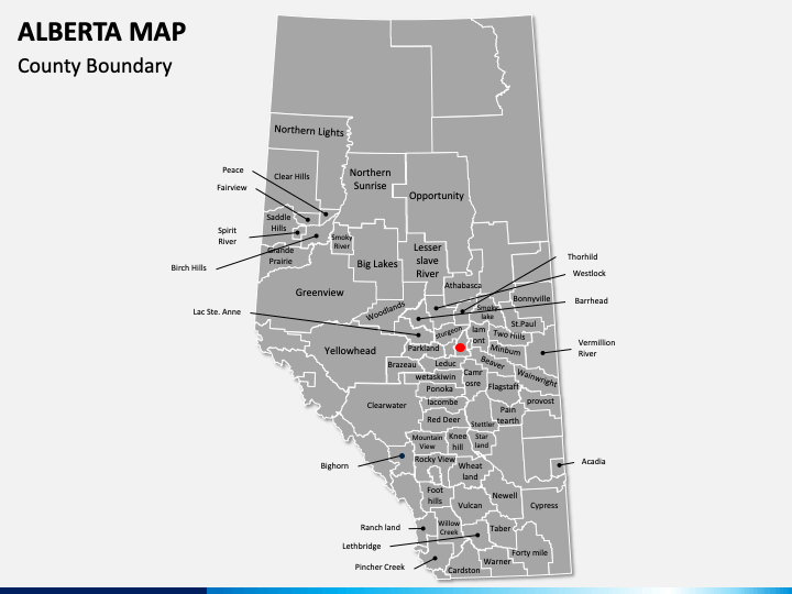
- a map showing all the boundaries of the county outlined very clearly
- a map illustrating the zoomed image of Alberta to showcase where it is located in Canada
- infographic of a man with the country’s flag in his hands.
- map pins, GPS markers, and other relevant icons to highlight any specific area on the map
Mind-Blowing Features
The slides are embellished with not only stunning visuals but also with some extraordinary features. It is available for MS PowerPoint, Apple Keynote, and Google Slides. It is entirely editable, which means you can resize and recolor the maps, add the text to the text placeholders, highlight any particular place, add the shading effects, etc. Even after multiple edits, the resolution will remain the same as slides contain only high-definition and vector-based maps.
So, download the set instantly, use the maps in your presentation, and put across your message in a meaningful manner.


