


Similar Products
- Sale

-
-
-
-
-


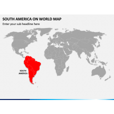
Our Dotted South America Map Shape PPT is the best pick to represent the major countries and regions of South America. The PowerPoint slide features an eye-pleasing dotted map infographic. Using it, you can highlight the rankings of South American countries in terms of land area, population, economic conditions, individual disposable income, literacy rate, etc. Tour operators can use the map illustration to present the major attractions of South America. This vector-based diagram can also be used to convey important messages graphically.
Aesthetic Features
- You can edit the illustration without investing much time or effort.
- The high-definition visual can be scaled to any screen size without disturbing the optical resolution.
- The users won’t encounter copyright issues, as each element is designed with utmost sincerity and complete attention to detail.
Download this feature-rich PPT to craft informative and engaging presentations in minutes!
Write Your Own Review

Related Products


