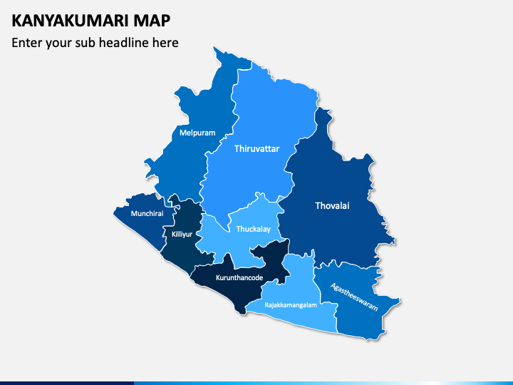
Download our Kanyakumari Map PPT template to showcase the political boundaries, landforms, and position of cities of Kanyakumari, a coastal town in Tamil Nadu. These versatile and multipurpose map infographics are a must-have to make your business and educational presentations more insightful and comprehensible.
Business professionals can leverage these map diagrams to represent their travel plans, sales territories, expansion plans, geographical segmentation to understand the target customers, etc. Educators can leverage these graphics to educate students about the culture and demographics of the city. Meteorologists can illustrate the weather and climatic conditions.
A Look at the Inclusions of the PPT
- One of the map diagrams depicts the towns and cities in the Kanyakumari district.
- An infographic of the India flag pin with enough text zones can be used to represent the things that make Kanyakumari so famous.
- An infographic of a slide man with an Indian flag can be used to demonstrate the contribution of Kanyakumari to the country’s economic growth.
- A few slides represent icons of sample map pins. You just need to define your map pins and then place them on the map to explain any specific information about Kanyakumari.
- Weather icons of sun, cloud, rain, thunderstorm, snowfall, etc., are showcased precisely.
Features
- After downloading once, you can use these slides standalone or add them to an existing presentation without any restrictions.
- The slides are detail-oriented, and the options to customize and use them in your own ways are endless.
- The size, color, shading, etc., of the maps can be easily altered, even if you don’t have technical knowledge.
- If you get stuck anywhere while using the deck, you can immediately contact our customer team.
Communicate your complex message in a simplified manner using this aesthetically appealing PowerPoint template. Get it now!


