


Similar Products
- Sale

- Sale
- Sale
-
-
-


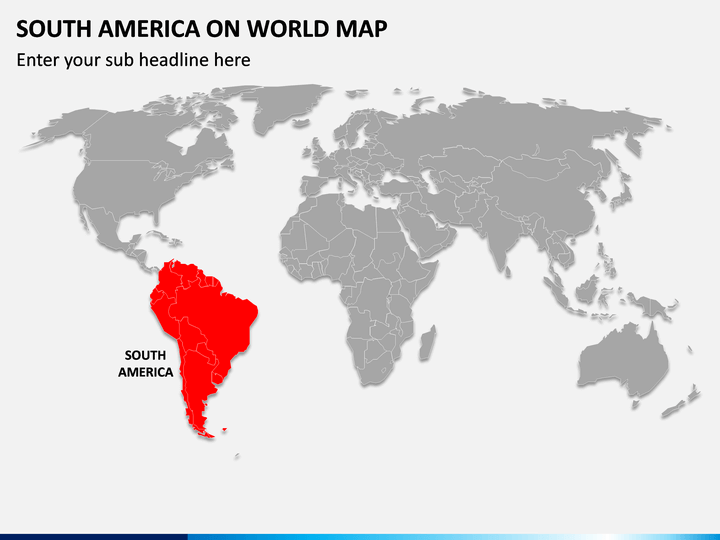
We have introduced stunning South America on World Map PPT to help you portray the exact location and the neighboring countries of South America on the world map. The PowerPoint slide features a vector-based world map diagram depicting South America in a distinct color. This map illustration comes in handy for educators, tour planners, meteorologists, and business professionals. Educators can use the slide to illustrate the major countries of the continent, their ethnic, cultural, and historical details, and much more. Meteorologists can leverage the illustration to highlight the weather and climatic conditions of South America. Market analysts can also present the continent's best markets in terms of business.
Features
- The illustration can be scaled to any screen size without disturbing the optical resolution.
- You can quickly align the graphic as per your preferences.
- Each attribute is designed with extensive attention to detail, leaving no room for copyright violation issues.
Download the PPT now to deliver engaging and informative presentations!
Write Your Own Review

Related Products


