Asia Maps
Editable Asia Maps for PowerPoint and Google Slides
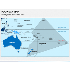
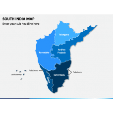
Lay your hands on our Asia Maps templates for PowerPoint and Google Slides to create mind-blowing presentations and showcase the complex information in a comprehensible manner to your audience. You can communicate about demographics, geography, food, culture, religion, and other interesting facts about different areas and regions of the continent using creative map layouts. The vector-based graphics are useful in grabbing the audience’s attention to the content on your slides and keeping them engaged throughout the slideshow.
Read More
- Sale

- Sale
- Sale
- Sale
- Sale
- Sale
- Sale
- Sale
- Sale


Ideal for All Professionals
Business professionals can use the eye-catching layouts to:
- Depict the branch offices of the company in each Asian country
- Showcase the company’s region-wise sales data and market share
- Highlight locations to expand their business
- Represent transport and logistics strategy
Educators can use the ready-made map infographics to provide information on:
- Politics, geography, history, current affairs, and relations between nations
- GDP of each country, major resources available in each country, figures of imports and exports, and more.
Professionals from the tourist industry can leverage the aesthetic map graphics to exhibit:
- Major attractions of all Asian countries
- Connectivity between the nations
- Best weather to visit Asian countries
Meteorologists can represent:
- Weather and climatic conditions of Asia
Best-in-Class Features
- The users can modify the sets without encountering challenges or restrictions.
- There is no space for copyright issues, as each attribute is crafted after extensive research.
- The quality of the map graphics won’t deteriorate even when scaled to a widescreen.

Diagram Finder