South America Maps
Editable South America Maps for PowerPoint and Google Slides
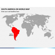
Leverage our South America Maps templates for PowerPoint and Google Slides featuring contemporary and professional map illustrations to display the region-specific data efficiently. These pre-designed decks comprise regional and demographic maps of South American countries, capital cities, major cities, islands, oceans, and many more.
You use the map layouts standalone or add them into an existing presentation to make information etched on the audience’s mind. So, lay your hands on them to earn lots of accolades from the audience.
Read More
- Sale

- Sale
- Sale
- Sale
- Sale
-
-
- Sale
- Sale


Who can Use these Multipurpose Templates?
Professionals from various domains, such as business, education, research, tourist industry, etc., can use these decks to illustrate multiple concepts in an interesting yet informative way.
Business professionals can leverage the map diagrams to depict:
- Marketing and sales strategies in different South American countries
- Business partners in various countries
- Business expansion plan
Educators can showcase the following information to students:
- Historical and cultural details
- Demographic information, like literacy rate, GDP, employment opportunities, population, etc.
- Geographical conditions
Travel planners can use the layouts to demonstrate:
- Sightseeing landmarks and tourist attractions
- Best time to visit South America
- Affordable travel routes and the South American countries’ connectivity with other regions of the world
The map infographics can also be used by city planners to showcase how the land is currently being used, where to put hospitals, schools, parks, etc., and the suggestions to better plan a city.
Spellbinding Features
- No user needs prior editing experience to customize these sets as per their requirements.
- There will be no copyright infringement issues, as our in-house designers have crafted each element from scratch.
- The high-quality map diagrams offer uninterrupted resolution on all screen dimensions
- 24*7 customer support services.

Diagram Finder