Arizona Map
Arizona Map
(6 Editable Slides)
Our Arizona Map PPT template is the best pick to depict and discuss your business and marketing opportunities through fully customizable maps of Arizona, the southwestern state of the United States. Using these creatively designed maps, professionals like school teachers can demonstrate the geographic details of this American state. These maps have been designed with a minimalist approach to highlight your information effectively and make it stand out. Created with high-quality graphics and vectors, this can be your ideal choice for a winning presentation. Download these PowerPoint slides now!
A Quick Glance at the PPT
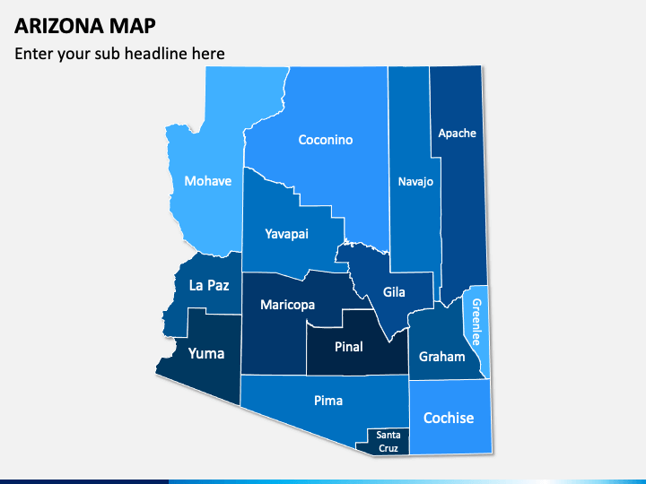
- One of the slides depicts a colorful political map, which you can use to display the counties in Arizona.
- A layout presents the map of the United States with a flag and a GPS pin, which business owners and entrepreneurs can leverage to depict their business presence in the region.
- Another layout comes with the icons of GPS markers comprising the symbols of planes, trains, buses, ships, and others that users can use to depict travel routes and location-related data.
- Using icons of different flags and map pins, you can easily highlight the neighborhoods and specific locations of Arizona on the map.
Features
- You can make the required changes to these map layouts without any fuss.
- The maps are unique and well-researched to keep copyright issues at bay.
- The deck offers high resolution even on large screens.
- We render ongoing customer support for quick resolution of all your download or compatibility-related issues.
So, download these maps right away and make a stunning presentation instantly!
